
Urban Densification and the Hidden Costs of Site Preparation: A Developer’s Guide
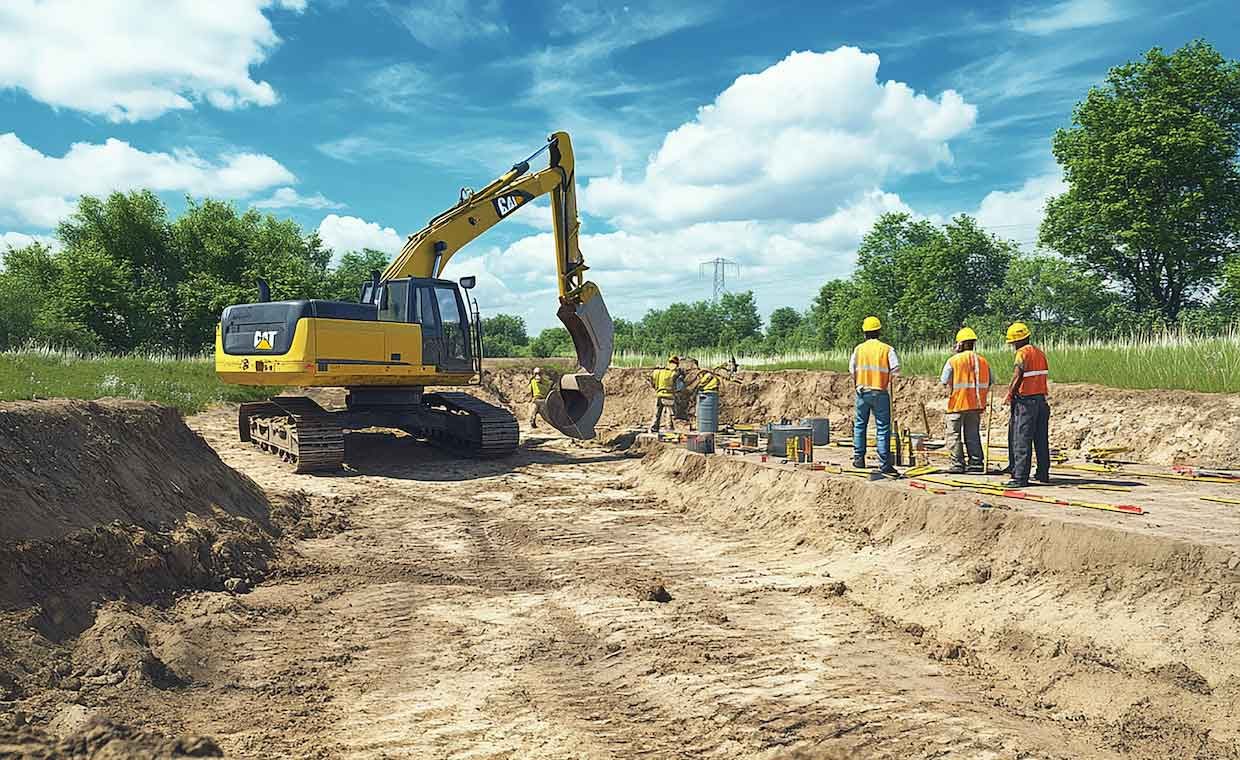
The closer we build to existing infrastructure, the higher the risk profile becomes. I have watched seven-figure urban infill projects stall for weeks because developers underestimated the impact of their site preparation on neighboring legacy structures. We aren’t just managing dirt and concrete anymore; we are managing proximity.
When you break ground in a dense metropolitan zone, the immediate environment reacts. Residents complain, adjacent foundations settle, and local councils issue stop-work orders. The financial bleed of a stalled site can wipe out a project’s contingency fund before the foundation is even poured. This article breaks down the proactive strategies developers must adopt to mitigate structural liabilities and keep urban construction schedules intact. We will look at environmental compliance, soil mechanics, community relations, and the physical monitoring systems that protect your bottom line.
The myth of the standard dilapidation report
Most developers treat dilapidation reports as an administrative box to check. A surveyor takes a few photos of the adjoining property, files a PDF, and everyone moves on. I genuinely don’t understand this approach. A static report proves what a building looked like yesterday. It does nothing to protect you when a neighbor claims your excavation cracked their retaining wall three weeks into the build.
To actually insulate a development from claims, baseline documentation needs continuous physical context. If you are blasting, driving piles, or operating heavy excavators near a fragile property line, static photos will not hold up against a coordinated legal complaint. You need active tracking. The courts increasingly favor property owners when developers cannot definitively prove their site activities were within safe limits. A photo from last month simply doesn’t answer the question of what happened yesterday at noon.
Soil mechanics and energy transmission
You cannot manage site risk without understanding what is happening beneath the surface. Different soil profiles transmit construction energy in radically different ways. If your site sits on a deep bed of soft clay, the energy from a vibratory roller can travel much further than you might expect, creating a rolling wave that damages brickwork on adjacent streets.
Conversely, working on solid bedrock often requires hydraulic hammering or blasting. The high-frequency energy generated here dissipates faster, but the localized impact is intense. Structural damage to an adjacent property sharing that same bedrock layer can happen in a matter of minutes.
I keep coming back to a project I reviewed last year in a dense commercial district. The contractor assumed standard setbacks would protect the neighboring historic masonry. They ignored the fact that a continuous layer of saturated soil acted as a conduit for the energy of their pile drivers. The resulting settlement cost the developer heavily in remediation. Understanding the geotechnical realities of your specific site is a non-negotiable first step.
Active environmental tracking
We often separate environmental controls into different silos, treating dust, noise, and ground movement as isolated issues. In reality, they are interconnected risk factors that councils view as a single nuisance metric. A site that generates excessive dust is usually the same site generating unchecked ground-borne energy.
You have to quantify the impact of your heavy machinery in real-time. When a hydraulic hammer goes to work, the energy waves travel directly into the footings of the building next door. Relying on human perception to gauge this impact is a gamble. Instead, deploying a localized vibration monitor along the boundary line provides exact, timestamped data.
If a neighbor complains about structural shaking at 2:00 PM on a Tuesday, you can pull the logs and prove your equipment was operating well below the required threshold. Data shuts down frivolous claims immediately. Furthermore, modern telemetry allows these sensors to trigger automatic text alerts to the site supervisor if limits are breached. This means you can throttle back operations before actual damage occurs, rather than finding out about the problem when a council inspector arrives unannounced.
Integrating community stakeholders
Transparency is cheaper than litigation. I often advise development teams to share non-sensitive site data directly with adjacent property owners. This sounds counterintuitive to old-guard project managers who prefer to keep everything behind the site fencing.
But think about the psychology of a neighbor. If their house rattles, they panic. If you warn them that controlled, monitored excavation will occur between specific hours, and that sensors will trigger automatic work-stoppages if limits are exceeded, the panic subsides.
Set up a straightforward communication protocol:
- Drop introductory letters outlining the exact phases of heavy civil work.
- Provide a direct phone number to the site supervisor, not a generic corporate hotline.
- Share the baseline parameters to let neighbors know you are actively measuring the physical impact on their specific street.
This approach turns adversarial neighbors into informed bystanders. People are far more tolerant of disruption when they feel respected and informed about the boundaries of that disruption.
Mandating tech in the tendering process
The construction industry is infamous for adopting fragmented technology. A superintendent might track deliveries on a tablet, manage labor in a spreadsheet, and leave environmental compliance entirely to a subcontractor. This fragmentation creates severe blind spots for the developer.
You need a centralized system for risk data. When reviewing a project’s SKILL.md file—or whatever internal standards repository your firm uses to track operating procedures—make sure active monitoring protocols are written directly into the tendering documents. Do not let the principal contractor decide how they will monitor the site after the contract is signed. Mandate the specific types of telemetry and reporting you require before you award the bid.
If environmental tracking is treated as an afterthought left to the demolition sub-contractor, you will never get the data you need in time to prevent a shutdown. The developer owns the ultimate risk, which means the developer must own the data standards.
Urban development is only getting tighter. As we squeeze larger structures into smaller, more heavily populated footprints, the margin for error shrinks to zero. Managing the physical realities of excavation and heavy machinery is no longer just a site supervisor’s problem; it is a core development strategy. If you rely on static reports and guesswork, you are leaving your project timeline at the mercy of the loudest neighborhood complaint. By adopting active tracking, understanding your geotechnical profile, and mandating transparent communication, you take control of the narrative and the liability. How is your current pipeline of projects proving their compliance when the ground starts shaking?